Mahmudlu (Mahmudlu)
Mahmudlu is a village and municipality in the Shamkir Rayon of Azerbaijan. It has a population of 3,252.
Mahmudlu village is located in the North-West of Azerbaijan in Shamkir district, 21 kilometers from the center of the district, on the right bank of the Shamkir river, on the Ganja-Gazakh plain. The population is 3259 people (as at 1 January 2005). The economy is based on animal husbandry, crop production, vineculture and horticulture. The village has a high school, a club, a library, a medical center, an ancient cemetery, a bridge, a monument to the martyrs, several artesians, various commercial and domestic facilities. The village has historically consisted of nine small tribes madmudlu, mashadigurbanli, kelbali, allakululi, gazakhli, yekenamazli, pusteli, yarakhmedli, gadzhymamedli. During the collectivization of the twentieth century, these tribes were moved to one place, and the settlement was named after the mahmudlu tribe. There was a time when this village was impenetrable jungle. Representatives of the Turkic-speaking of Mahmudlu tribe arrived in Azerbaijan at different times. The sources also referred to the inhabitants of Mahmudlu, who spend their winter in Nagorno-Karabakh and summer in Zangezur. Mahmudli people living in the East of lake Van in Turkey, came to the Caucasus in the XVI-XVII centuries, including in Azerbaijan. Don Juan of Persia named mahmudlu tribe in 25th place in the list of gizilbash tribes and their branches. There are also Mahmudlu villages in Jabrail, Fuzuli and Gubadli districts. In the Zangezur district of Ganja (now Gafan district), Mahmudlu village was abandoned (in 1988 its population was expelled).
Mahmudlu village is located in the North-West of Azerbaijan in Shamkir district, 21 kilometers from the center of the district, on the right bank of the Shamkir river, on the Ganja-Gazakh plain. The population is 3259 people (as at 1 January 2005). The economy is based on animal husbandry, crop production, vineculture and horticulture. The village has a high school, a club, a library, a medical center, an ancient cemetery, a bridge, a monument to the martyrs, several artesians, various commercial and domestic facilities. The village has historically consisted of nine small tribes madmudlu, mashadigurbanli, kelbali, allakululi, gazakhli, yekenamazli, pusteli, yarakhmedli, gadzhymamedli. During the collectivization of the twentieth century, these tribes were moved to one place, and the settlement was named after the mahmudlu tribe. There was a time when this village was impenetrable jungle. Representatives of the Turkic-speaking of Mahmudlu tribe arrived in Azerbaijan at different times. The sources also referred to the inhabitants of Mahmudlu, who spend their winter in Nagorno-Karabakh and summer in Zangezur. Mahmudli people living in the East of lake Van in Turkey, came to the Caucasus in the XVI-XVII centuries, including in Azerbaijan. Don Juan of Persia named mahmudlu tribe in 25th place in the list of gizilbash tribes and their branches. There are also Mahmudlu villages in Jabrail, Fuzuli and Gubadli districts. In the Zangezur district of Ganja (now Gafan district), Mahmudlu village was abandoned (in 1988 its population was expelled).
Map - Mahmudlu (Mahmudlu)
Map
Country - Azerbaijan
 |
 |
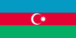
| Flag of Azerbaijan | |
The Azerbaijan Democratic Republic proclaimed its independence from the Transcaucasian Democratic Federative Republic in 1918 and became the first secular democratic Muslim-majority state. In 1920, the country was incorporated into the Soviet Union as the Azerbaijan SSR. The modern Republic of Azerbaijan proclaimed its independence on 30 August 1991, shortly before the dissolution of the Soviet Union in the same year. In September 1991, the ethnic Armenian majority of the Nagorno-Karabakh region formed the self-proclaimed Republic of Artsakh. The region and seven surrounding districts are internationally recognized as part of Azerbaijan pending a solution to the status of the Nagorno-Karabakh through negotiations facilitated by the OSCE, although became de facto independent with the end of the First Nagorno-Karabakh War in 1994. Following the Second Nagorno-Karabakh War in 2020, the seven districts and parts of Nagorno-Karabakh were returned to Azerbaijani control.
Currency / Language
| ISO | Currency | Symbol | Significant figures |
|---|---|---|---|
| AZN | Azerbaijani manat | ₼ | 2 |
| ISO | Language |
|---|---|
| HY | Armenian language |
| AZ | Azerbaijani language |
| RU | Russian language |


